Meetings as scheduled on their site
City Council Chambers, 1901 Airport Road
South Lake Tahoe, California 96150
Fairy Tale Landscapes
Every fairy tale landscape is a stones throw away from Tahoe to Pyramid to Black Rock.
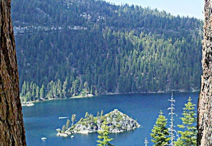
Tahoe is the pride and joy of the Reno area, with beautiful Lake Tahoe bringing millions of tourists every year for its breath-taking mountain views (6225 feet above sea level), hiking, skiing, swimming, and related activities. The Lake is the head of the Truckee River, creating a natural connection between these symbiotic cities that offer so much to each other in commerce and entertainment, for both permanent residents and tourists. The 191.6 mi² Lake Tahoe attracts people who want to experience everything life has to offer for outdoor enthusiasts.
The Mount Rose Ski Area hosted the 1960 Winter Olympics and 550 inches of snow can fall in a season.
Logan Meadows - This historic cove is hidden between the Diamond Peak Ski Resort Mountains and Bowers Mansion farmlands
Meetings as scheduled on their site
City Council Chambers, 1901 Airport Road
South Lake Tahoe, California 96150

Every Weekday
One of the largest and most generous rotary districts in the world.
Growing Neighborhood Connections
Teamwork online and in person